Practical Guide To Becoming A Survey Drone Pilot In India
11 Aug 2023 | 08 min read
Do you aspire to be a drone pilot and are keen to grow your career in aerial surveying? Look no further! In this blog post, we will take you through the essential steps to start your journey as a survey drone pilot in India.
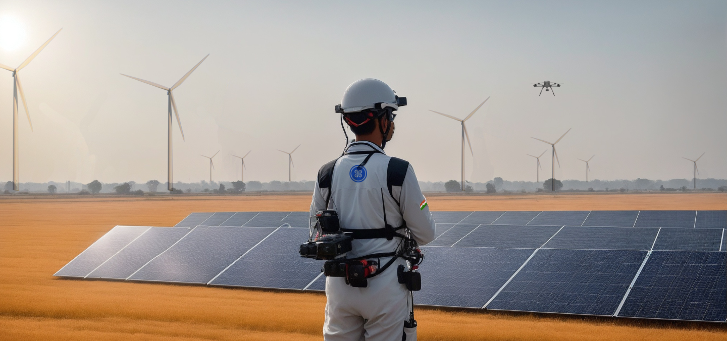
In recent years, the use of drones for surveying has gained significant traction in India. Survey drone pilots play a crucial role in capturing high-resolution aerial data, enabling efficient and accurate mapping, surveying, and monitoring. As the demand for aerial data collection continues to grow, the role of survey drone pilots has become increasingly vital. At TropoGo, we believe in nurturing talent and supporting aspiring drone pilots. So, let's delve into the exciting world of aerial surveying and discover how you can be a part of it!
Becoming a survey drone pilot in India involves a deep understanding of the regulatory landscape that governs drone operations. The Directorate General of Civil Aviation (DGCA) plays a vital role in formulating and implementing regulations to ensure the safe and responsible use of drones across the country. Aspiring drone pilots must familiarise themselves with the DGCA's guidelines and requirements, as adherence to these regulations is essential for a successful career.
The DGCA has established a comprehensive set of guidelines that cover various aspects of drone operations. These guidelines encompass Airspace Restrictions, Drone Registration, Pilot Licensing, operational Limitations, and Safety Protocols. As a potential survey drone pilot, it is crucial to thoroughly study and comprehend these regulations to ensure safe and legal operations.
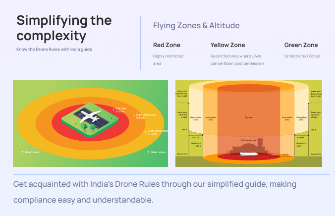
To Know more, Click on the link below :
https://tropogo.com/india-guides/drone-laws/generic-rules
For a successful career as a survey drone pilot, it is essential to acquire the necessary training and knowledge to operate drones safely and effectively. Operating drones commercially in India requires a deep understanding of drone operation principles, flight planning, safety protocols, and data collection techniques. By enrolling in Drone Training Programs, you can develop these skills and expertise needed to excel in this field.
Remote Pilot Training organization (RPTO) across India offer specialised courses tailored to the requirements of Survey drone pilots. These courses cover a wide range of topics, providing in-depth knowledge of drone technology, flight dynamics, navigation systems, and emergency procedures.
Flight planning is a crucial aspect of drone operations, and comprehensive training programs emphasise its significance. You will learn how to assess the surveying area, identify potential obstacles, and plan efficient flight paths to capture accurate and high-resolution data. Training also encompasses Pre-Flight and Post-Flight Checklists to ensure the drone's readiness and the proper handling of data collected during surveys.
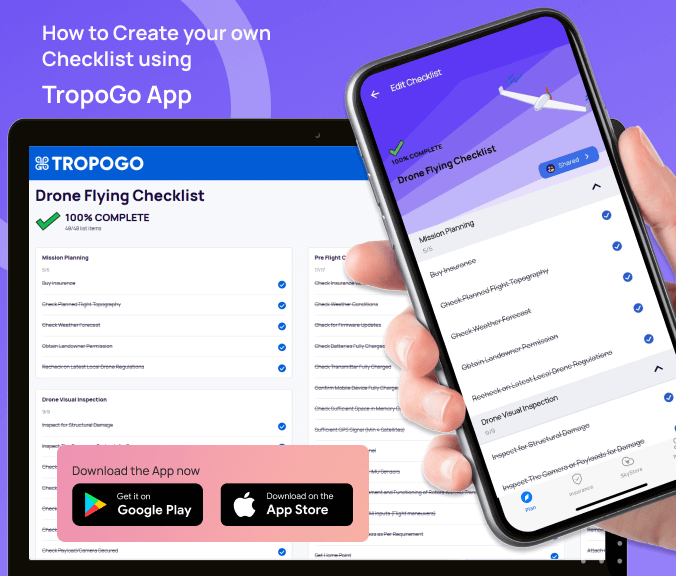
To Create your Checklist, Click on the Download button above
Data collection techniques form the foundation of surveying with drones. These techniques involve capturing precise and reliable aerial data using specialized sensors and cameras. Training programs equip you with the knowledge of different sensors, their applications, and optimal data collection methodologies. You will also learn how to process and analyze the collected data to derive accurate survey results.
To ensure legal and compliant operation of drones for commercial purposes in India, obtaining a Remote Pilot Certificate (RPC) is essential. The RPC asserts that you have met the required standards and possess the necessary knowledge and skills to operate drones in accordance with Indian aviation regulations.
Acquiring the RPC not only validates your capabilities as a professional survey drone pilot but also ensures that you are equipped with the knowledge to mitigate risks, prevent accidents, and navigate through challenging scenarios. The Certificate is a testament to your commitment to professionalism and adherence to aviation regulations.
Registering yourself as a remote pilot with the DGCA is a fundamental requirement for operating drones commercially in India. It is a formal acknowledgment of your status as a licensed and authorised drone pilot, and it ensures your compliance with the regulatory framework.
During the registration process, you will be asked to provide essential documents to verify your identity and qualifications. These documents may include your Aadhaar card, passport, educational certificates, and any other identification documents as specified by the DGCA. It is crucial to ensure that all the submitted documents are accurate and up to date.
By registering your drone with the DGCA, you contribute to the overall safety and security of the airspace. It allows the authorities to maintain a record of all authorised drones operating in the country, ensuring accountability and traceability. Additionally, registration facilitates the implementation of necessary safety measures and enables efficient communication between drone pilots and the relevant authorities.
Becoming a proficient survey drone pilot goes beyond theoretical knowledge and licensing. Practical experience is a vital component that enhances your skills in operating drones for surveying purposes. By actively engaging in practical flying, you can bridge the gap between theory and real-world applications.
One way to gain practical experience is by collaborating with seasoned professionals in the field. Seek opportunities to work alongside experienced surveyors, drone pilots, and industry experts. Their guidance and mentorship will provide valuable insights into best practices, effective flight manoeuvres, and efficient data collection methods. By observing and learning from their expertise, you can refine your skills and gain a deeper understanding of the intricacies of surveying with drones.
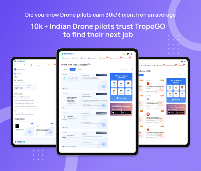
Explore and apply for Drone jobs and Government Drone Tenders in one place
To Know more, Click on the link below :
Joining organisations involved in surveying projects is another avenue to gain hands-on experience. These organisations often require the assistance of skilled drone pilots for various surveying tasks, such as land mapping, infrastructure inspections, or environmental monitoring. By actively participating in such projects, you can apply your theoretical knowledge in real-world scenarios, learn how to navigate challenging environments, and adapt to specific surveying requirements.
During practical experiences, you will encounter various challenges that will test your decision-making skills and problem-solving abilities. As you gain exposure to different scenarios, you will learn how to assess and mitigate risks, ensure safety protocols are followed, and optimise data collection processes. These experiences contribute to your professional growth and prepare you for diverse and demanding surveying projects.
In addition to being able to fly a drone, a survey drone pilot is also expected to have a good grasp on surveying principles such as Map interpretation, Data Analysis, Photogrammetry Software to create a point cloud, Orthomosaic or digital elevation models, report generation and Visualisation software. While an RPTO gives the fundamental training needed to become a survey drone pilot, a job in this field requires hands-on experience at post processing as well.
Networking provides a platform for knowledge exchange, collaboration, and professional growth. Engaging with Professionals in the Drone Industry, such as experienced pilots, surveyors, and industry experts, can offer valuable insights, advice, and mentorship. Their guidance can enhance your understanding of the industry, provide career guidance, and open doors to new possibilities.
Attending industry conferences, workshops, and seminars allows you to stay updated with the latest trends, technological advancements, and regulatory changes. These events provide opportunities to meet industry leaders, experts, and potential clients. Engaging in conversations, participating in panel discussions, and sharing experiences can help you establish yourself as a knowledgeable and respected professional in the field.
Joining relevant Online Communities, Forums, and Social Media Groups allows you to connect with a wider audience of like-minded professionals, both nationally and internationally. These platforms provide a space to share your insights, learn from others, and collaborate on projects. Participating in discussions, contributing to the community, and seeking advice can help you build valuable connections and gain exposure in the industry.
Create your Go Getters Drone Pilot Profile today on TropoGo App and be the part of fastest growing drone network.

To create your pilot profile, click on the download button above.
Building a drone pilot portfolio is crucial for showcasing your skills and capabilities as a survey drone pilot. Your portfolio should include examples of your work, highlighting the projects you have undertaken, the data you have collected, and the outcomes you have achieved. High-quality photographs, videos, or 3D models captured during surveying missions can provide tangible evidence of your abilities and demonstrate your proficiency in using drones for surveying purposes.
The drone industry in India is experiencing a rapid transformation, with drones becoming indispensable tools for aerial data collection. Becoming a survey drone pilot in India is an exciting and fulfilling journey that requires a blend of theoretical knowledge, practical experience, and unwavering commitment to regulatory compliance. By following the steps outlined in this guide, aspiring drone pilots can acquire the necessary skills, certificate, and experience to soar to new heights in the surveying industry.

Download for Android : TropoGo - Drone Jobs & Tools - Apps on Google Play Download for iOS : TropoGo - Drone Insurance & Jobs on the App Store